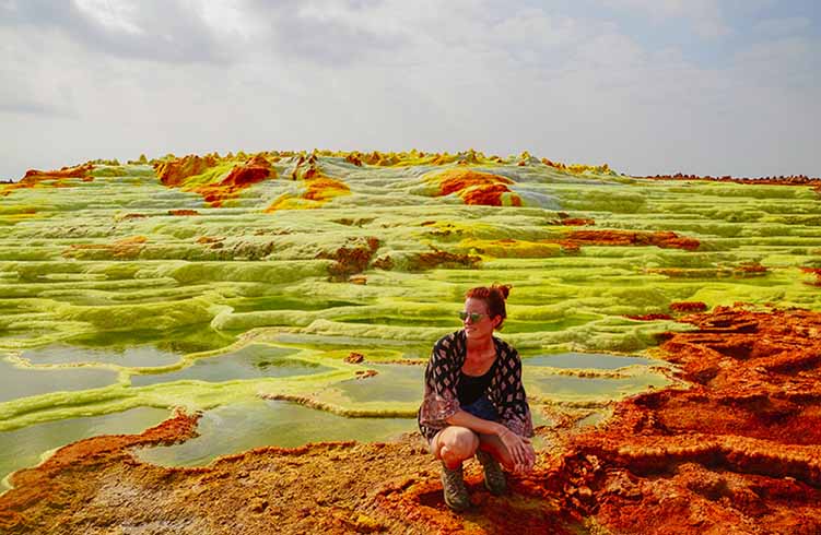
The Danakil Depression, located in northeastern Ethiopia, is widely recognized by geographers as one of the most extreme environments on Earth. Sitting more than 100 meters below sea level, this geological basin lies at the intersection of three tectonic plates, making it a region of intense volcanic and seismic activity. Average temperatures frequently exceed 40°C, and rainfall is minimal, creating conditions that challenge both human survival and scientific exploration. Its harsh climate and striking terrain have made the Danakil Depression a critical site for studying Earth’s dynamic crust.
From a geological perspective, the Danakil Depression offers rare insight into continental rifting—the process by which continents slowly split apart. Lava lakes, sulfur springs, salt flats, and hydrothermal fields dominate the landscape, providing researchers with real-time examples of how new ocean basins may eventually form. Volcanologists and geographers regularly study the region’s active volcanoes, such as Erta Ale, to better understand magma movement and plate tectonics. These ongoing studies reinforce the area’s importance within academic geography and Earth science.
Beyond its scientific value, the Danakil Depression also holds cultural and economic significance. Indigenous Afar communities have harvested salt from the region for centuries, navigating the extreme environment with traditional knowledge passed down through generations. Today, the area attracts geographers, researchers, and responsible travelers seeking to understand Earth’s most volatile environments. The Danakil Depression stands as a powerful example of how geography shapes both natural systems and human adaptation.