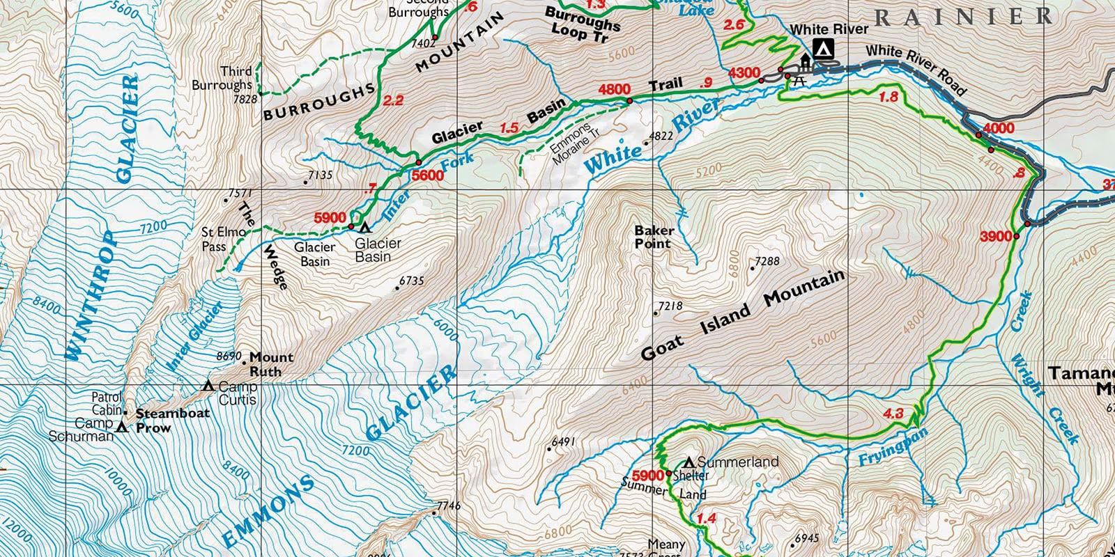
solsticeuniversity.com – Topographic maps are invaluable tools for understanding the physical features of a landscape. Used by hikers, geographers, engineers, and environmentalists, these maps offer a detailed representation of the terrain, helping users visualize and navigate the natural and built environment. Learning how to read a topographic map is an essential skill that combines knowledge of symbols, scales, and contour lines.
What is a Topographic Map?
A topographic map is a two-dimensional representation of a three-dimensional landscape. Unlike traditional maps, which focus primarily on roads or political boundaries, topographic maps depict elevation, landforms, and physical features using contour lines, symbols, and color shading. These maps are essential for activities such as hiking, land surveying, construction planning, and environmental studies.
Key Features of a Topographic Map
- Contour Lines:
- Contour lines are the backbone of a topographic map. These lines connect points of equal elevation, illustrating the height and shape of the terrain.
- The closer the contour lines are, the steeper the slope. Widely spaced lines indicate gentle slopes or flat terrain.
- Contour intervals, the vertical distance between adjacent contour lines, are consistent across the map and are usually noted in the map’s legend.
- Symbols and Legend:
- Topographic maps use standardized symbols to represent various features, such as forests, rivers, roads, and buildings.
- The legend serves as a key, explaining the meaning of the symbols, contour intervals, and other details.
- Scale:
- The scale of a map indicates the ratio between distances on the map and actual distances on the ground. For example, a 1:25,000 scale means that 1 unit on the map equals 25,000 units in reality.
- Understanding the scale is crucial for measuring distances accurately.
- Grid System:
- Topographic maps often include a coordinate grid, such as latitude and longitude or a Universal Transverse Mercator (UTM) grid, to help pinpoint locations.
- Color Coding:
- Different colors are used to represent various landforms and features. For example, green indicates vegetation, blue represents water bodies, and brown is used for contour lines.
How to Read a Topographic Map
- Understand the Legend:
- Begin by reviewing the map’s legend to familiarize yourself with its symbols, contour interval, and scale.
- Identify Landforms:
- Use contour lines to identify hills, valleys, ridges, and depressions. A series of concentric contour lines with increasing elevation indicates a hill, while a valley is shown by V-shaped lines pointing uphill.
- Determine Elevation:
- Locate the index contours, which are thicker contour lines marked with elevation values, to understand the baseline height.
- Use the contour interval to calculate the elevation of other points.
- Analyze Slopes:
- Observe the spacing of contour lines to determine the steepness of the terrain. Close lines signify steep slopes, while widely spaced lines indicate gentle or flat areas.
- Measure Distances:
- Use the scale to measure straight-line distances or follow the contours to estimate the true distance along a path.
- Orient the Map:
- Align the map with the cardinal directions using a compass to better understand your surroundings and navigate effectively.
Practical Applications of Topographic Maps
- Hiking and Outdoor Activities:
- Topographic maps are essential for route planning and navigation in wilderness areas. They help identify trails, water sources, and potential hazards like steep slopes or cliffs.
- Urban and Rural Planning:
- Urban planners and engineers use topographic maps to design infrastructure, assess flood risks, and plan land use.
- Environmental Studies:
- Geographers and environmentalists use these maps to study landforms, erosion patterns, and habitat distributions.
- Military Operations:
- The military relies on topographic maps for strategic planning and movement in diverse terrains.
Tips for Mastering Topographic Map Reading
- Practice Regularly:
- The more you use topographic maps, the more comfortable you’ll become with interpreting their features.
- Use a Compass:
- Combine your map-reading skills with a compass to enhance your navigation accuracy.
- Visualize the Terrain:
- Try to mentally convert the 2D map into a 3D landscape to better understand the terrain.
- Check for Updates:
- Ensure you’re using the most recent version of a map, as features and trails can change over time.
Conclusion
Reading a topographic map is a valuable skill that opens up new possibilities for exploration and understanding of the natural world. Whether you’re trekking through mountainous terrain or analyzing land use for a project, mastering topographic map reading allows you to navigate and interpret landscapes with confidence. With practice and attention to detail, anyone can become proficient in this essential skill.


