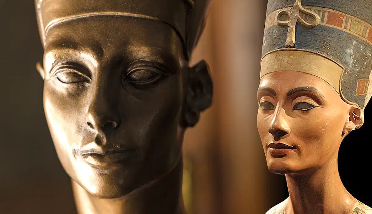
Neferneferuaten, Egypt’s Mysterious Female Pharaoh of the Amarna Period
Neferneferuaten ruled ancient Egypt during the turbulent final years of the Amarna Period (circa 1335-1332 BC), a time of religious and artistic upheaval. Whereas much of popular history centers on Akhenaten or Tutankhamun, Neferneferuaten’s reign remains shrouded in uncertainty. Scholars debate whether she was the same person as Nefertiti orContinue Reading

Ancient Glow, How Biofluorescence Illuminated the Evolution of Coral Reef Fish
Biofluorescence—the ability of living organisms to absorb high-energy light and reemit it in vivid colors—has recently been shown to have an astonishingly deep-rooted history in reef fish. Scientists from the American Museum of Natural History discovered that this glowing trait first emerged around 112 million years ago, concurrently evolving independentlyContinue Reading

Understanding the Scorigami Phenomenon in the NFL
In the realm of American football, the term “Scorigami” refers to a unique final score that has never occurred in the history of the NFL. Coined by sports enthusiast Jon Bois, Scorigami has become a fascinating aspect for fans and analysts alike, highlighting the unpredictable nature of the game. TheContinue Reading

Whistled Languages, Nature’s Morse Code Across Mountains and Valleys
Whistled languages are ingenious adaptations of spoken language—transformed into whistles, enabling long-distance communication in rugged landscapes where voices would falter. These systems mimic speech intonation, rhythm, and phonetics, allowing entire conversations to flow through whistling alone. This remarkable mode of expression exists in at least 80 cultures, from the CanaryContinue Reading

Hidden Door, The AI Storytelling Game Bridging Choose-Your-Own-Adventure with Literary Classics
Enter Hidden Door, a recent addition to AI-driven entertainment, now in early access. This innovative platform transforms interactive storytelling by blending choose-your-own-adventure mechanics with structured, familiar narratives—ranging from The Wizard of Oz to Pride and Prejudice. As players craft characters and navigate storylines, Hidden Door maintains narrative coherence and pacingContinue Reading

When Reading Became Silent: The Forgotten Shift That Changed Our Inner Lives
In ancient times, reading aloud was the norm—silent reading was considered unusual. Saint Augustine’s 4th-century writings highlight this cultural shift when he described Saint Ambrose’s extraordinary habit of silently reading—his eyes scanning the page while his tongue stayed still—remarking that “his voice and tongue were at rest” This rare practiceContinue Reading

Davis Strait Proto-Microcontinent: Unveiling a Hidden Landmass Between Greenland and Canada
Deep beneath the frigid waters between Greenland and Canada lies a remarkable geological revelation: the Davis Strait proto-microcontinent. This submerged landmass, about 19 to 24 km thick, represents an incomplete fragment of continental crust that failed to fully detach—essentially a “failed” microcontinent. Its formation traces back to tectonic shifts betweenContinue Reading
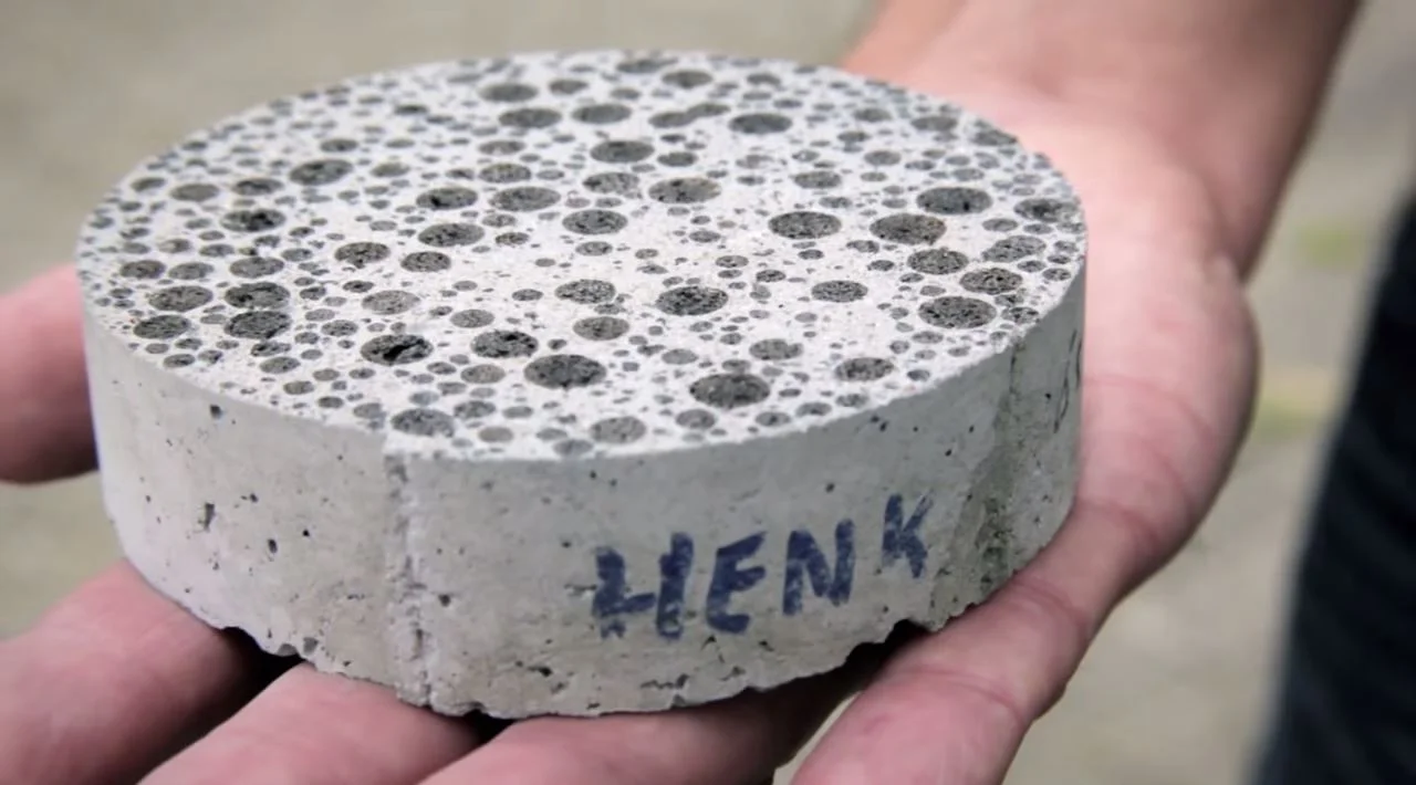
The Biodegradable Concrete That Heals Itself
Modern infrastructure relies heavily on concrete, yet traditional mixes crack and deteriorate over time, demanding costly repairs. Enter self-healing concrete: an innovative material infused with specialized bacteria that become active when cracks form. These microorganisms produce limestone to naturally seal fissures, significantly extending the lifespan of bridges, buildings, and roads—whileContinue Reading

How Virtual Sports Simulations Foster Real-World Teamwork Skills
In today’s digitally evolved world, virtual sports simulations do more than entertain—they cultivate essential teamwork skills transferable to real-life environments. Interactive sports games offer dynamic platforms where players must collaborate, coordinate strategies, and adapt to evolving scenarios. These immersive experiences challenge users to communicate effectively, make quick decisions, and supportContinue Reading

K2-18b’s Atmospheric Clues: A Hycean Planet and the Search for Life
K2-18b has captivated the scientific world as one of the most compelling Hycean planet candidates—exoplanets with hydrogen-rich atmospheres and subsurface liquid oceans. Observations from the James Webb Space Telescope detected prominent molecules like water vapor, methane, carbon dioxide, and, notably, dimethyl sulfide (DMS)—a compound produced by marine algae on EarthContinue Reading